Introduction
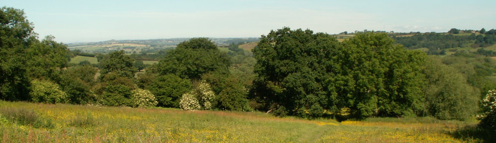
In 2024, the East Keswick Wildlife Trust began creating detailed photogrammetric maps of every reserve we own or manage. These maps will form a long-term visual record of how our landscapes change over time, supporting conservation work and giving members a new way to explore the reserves.
The maps are available on the Maps Page
If you have questions or comments about the project, please contact jbhosmer@hotmail.com
Why Drone Mapping?
Modern drone technologies allow us to document habitats with a level of detail that was once possible only with expensive aircraft surveys. For conservation work, this means:
- A clearer understanding of habitat structure
- Better monitoring of change over years and decades
- More accurate planning for restoration and management
- A visual archive that can be shared with members and the wider community
Two main technologies exist for creating accurate 2D and 3D maps: LIDAR and Photogrammetry.
LIDAR
LIDAR uses laser pulses to measure the shape of the ground and vegetation. It is extremely accurate and produces highly detailed 3D models. However, LIDAR equipment is heavy and costly; a typical drone-mounted system can cost £15,000–£20,000.
Photogrammetry
Photogrammetry uses a high-quality camera to capture overlapping photographs, which are then processed into accurate maps and 3D models. The equipment is lighter and far more affordable — typically £1,000–£4,000 — making it the practical choice for the Trust. While photogrammetry cannot match LIDAR’s fine-scale 3D detail, it provides excellent results for habitat mapping and long-term monitoring.
How Photogrammetry Works
To create a reliable map, the drone flies a carefully planned route, capturing thousands of overlapping photographs — usually with 80–85% overlap in both directions. Each image contains geometric and positional information that allows processing software to reconstruct the landscape in 2D and 3D.A typical reserve field, such as Bardsey Fields, may require up to 2,000 photographs for a single mapping session.
The Drone Platform
The project began with a DJI Mavic 2 Zoom, capable of flying semi-autonomous missions. In 2025, this was replaced by the DJI Mavic 3 Enterprise (M3E), which offers major improvements for mapping:
- 20-megapixel camera with a mechanical shutter
- Reduces motion blur
- Allows faster flight speeds
- Extends battery life and mission duration
- Real-Time Kinematic (RTK) GPS add-on
- Provides survey-grade positional accuracy
- Reduces location error from 3–6 metres to around 1 cm
Mission plans created for the earlier drone remain compatible with the M3E, and the software automatically adjusts flight parameters to take advantage of the newer hardware.
The ability to repeat missions precisely — same route, same altitude, same camera angle — is essential. Repeatability ensures that maps from different years align accurately, making long-term comparison far easier and more meaningful for members.
Achieving Survey-Grade Location Accuracy
Accurate mapping depends on accurate positioning. Standard GNSS (GPS, Galileo, GLONASS, Beidou) typically provides 3–6 metres of accuracy — not sufficient for ecological monitoring.
To overcome this, the Trust installed a GNSS RTK base station at a central location within the reserves. Because the base station’s position is precisely known, it can measure satellite errors in real time and broadcast corrections over the internet. Any RTK-enabled receiver within 35 km can then achieve centimetre-level accuracy.
The base station was calibrated using precise positioning tools provided by the Government of Canada, and its correction data is publicly available on https://rtk2go.com:2101 with a mount point of EKWT_RTK for use by farmers, surveyors, and construction firms within range.
It is worth noting that most public mapping services are only accurate to around 3 metres. As a result, EKWT’s RTK-based maps will align perfectly with one another but may appear slightly offset when compared with public maps.
Mapping Software
We currently use Maps Made Easy, an affordable photogrammetry service operated by Drones Made Easy in the United States. Their companion app, Map Pilot Pro, allows us to plan, save, and fly repeatable missions across all reserves.
Depending on the size of a site, a mapping session may require several hundred to nearly two thousand photographs. Processing these images can take anywhere from a few hours to over ten hours, depending on complexity.
We are also evaluating WebODM (Web Open Drone Map), an open-source mapping platform. Early results have been excellent, and we plan to transition fully to WebODM over time. In the meantime, we will begin publishing 3D models generated by WebODM as they become available.
Conclusion
The EKWT Mapping Project is still in its early stages, and our tools and methods will continue to evolve. What will remain constant is our commitment to creating a long-term, high-quality visual record of the reserves — a resource that will support conservation work and help members appreciate how these landscapes change over time.
We hope you find the maps informative, engaging, and useful as we continue documenting the Trust’s work for years to come.
View all the current EKWT maps on the Maps Page